Building date: 1804-1807
Original use:
Corner structures:
Mortar application and content:
Types and uses of stones:
Types and choice of windows:
Structures with similar masonry details:
Masons who worked on building:
Unique features:
Map views courtesy Google Maps. Address is Google Earth confirmed; 50°48'57.24"N 0°04'37.30"W.
Sussex, England Maps.
Ovingdean Rectory. Rectory Cottage and behind it the Ovingdean Rectory. The St. Wulframs Church is to the right hidden by the trees and cobblestone wall.
Church grounds view. Rotate the view to see a high cobblestone wall surrounding the church cemetery.
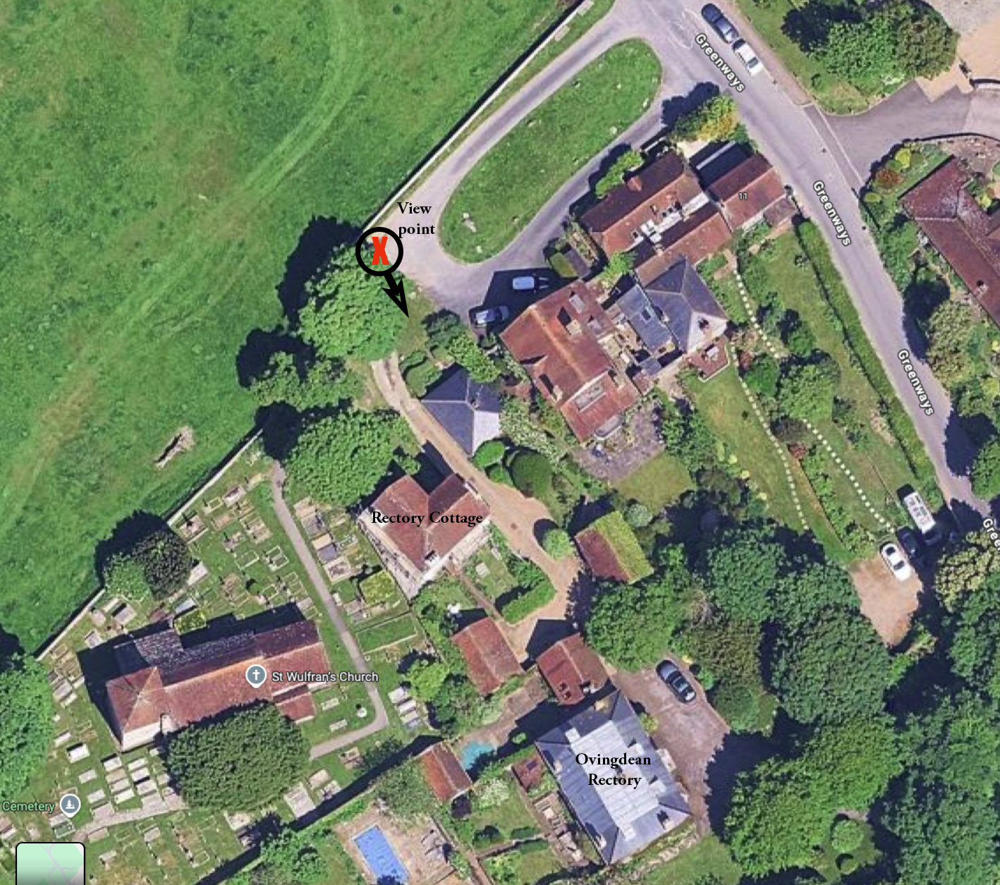
Satellite view showing the viewpoint of the Google Maps street level view with rectories and church locations noted.
- "Cobblestone Landmarks of New York State", 1978, by Olaf William Shelgren, Jr., Cary Lattin, and Robert W. Frasch, Photographs by Gerda Peterich: Name reference, St Wulfram's Church Rectory
- Page 11
 Images Not Available.jpg |
